ArcGIS Pro
Visualize and analyze data in 2D, 3D, and 4D and share projects with your team or anyone around the world.
Find balance among land, wildlife, and humans
Natural resource management agencies protect our communities’ natural and cultural resources. Understanding the relationships between ecosystems and our impacts on them requires a geographic approach. With GIS, managers can monitor species and ecosystems in real time or take mobile tools offline for monitoring in remote areas. Capture the extent of land and wildlife management activities and measure their impact through time. Turn this data into a conservation plan with spatial analytics.
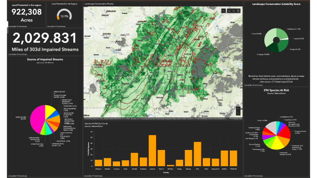
Successful land resource protection begins with setting priorities. Use GIS to assess the status of wildlife resources, distribution, and threats and track changes. With GIS you can compare scenarios against future modeled conditions to target and plan your stewardship activities.
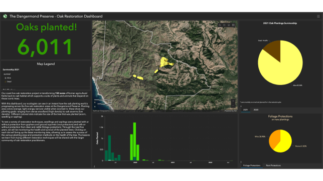
Resource protection includes stewarding and restoring our natural resources. With GIS, land and wildlife managers can track assets and resources in the field and keep staff safe while executing management plans. GIS allows land and wildlife managers to track stewardship over space and time to measure progress and outcomes.
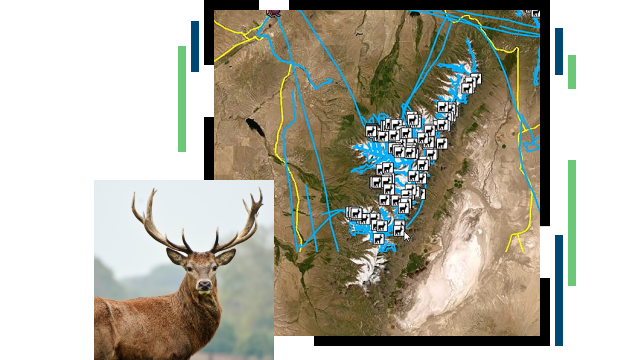
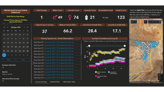
Land and wildlife managers can use GIS to analyze data from collars, cameras, or other sensor networks to remotely monitor species, ecosystems, and environmental variables; automatically detect change using imagery and artificial intelligence (AI)/machine learning (ML); or work in remote areas to efficiently collect observations in the field.
Education and outreach are critical components of successful land and wildlife management. GIS allows land and wildlife managers to scale impact through volunteer initiatives, collaborate with stakeholders to help inform policy decisions, and communicate success.
BLOG
The South Carolina Natural Heritage Data program uses GIS to document habitats and threatened species to safeguard the state’s uniqueness.
Read the storyUSER STORY
Montana Department of Natural Resources and Conservation is using ArcGIS Hub to marry forest conditions and wildfire risk for collaboration.
Read the storyUSER STORY
Big Horn County Weed and Pest Control District employs Web GIS to get a real-time view of operations, enabling them to save thousands of dollars.
Read the case studyARTICLE
The Glacier National Park’s Common Loon Citizen Science Project gives people an easy-to-use mobile app that puts observations on a real-time map.
Read the articleVIDEO
The Nevada Department of Wildlife helps preserve the elk population by using GIS to improve aerial wildlife surveys and streamline data collection.
USER STORY
Seatuck Environmental uses GIS to facilitate volunteers’ observations about water conditions to study the ecology of fish in relationship to humans.
Read the case studyVisualize and analyze data in 2D, 3D, and 4D and share projects with your team or anyone around the world.
Work together with internal and external stakeholders to track progress, improve outcomes, and create vibrant communities.
Use this mobile solution to capture data, perform inspections, take notes, and share information with the office.
Easily consume, visualize, and analyze streaming data in real time from sensor networks within the Internet of Things (IoT).
Routinely inspect conservation easements and monitor conservation easement programs.
Increase participation in outdoor activities and understand recreation license trends.
Capture wildlife observations and monitor wildlife populations in and around protected areas.