3D Visualization

ArcGIS enables immersive 3D visualization, exploration, and enhanced data comprehension for effective communication

Find the right solution
A 3D, aerial view of downtown Boston, Massachusetts, with three buildings highlighted in different colors

Enhance understanding and collaboration with 3D visualization

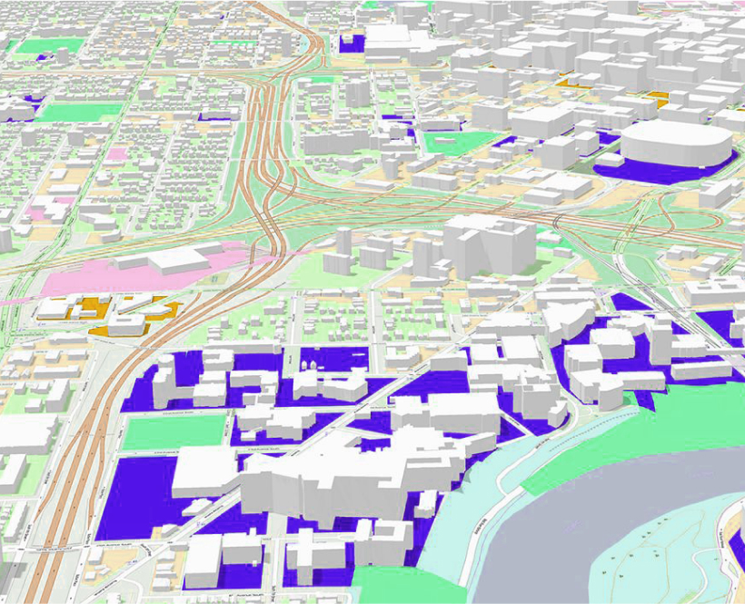
ArcGIS enables immersive 3D visualization to explore spatial data in dynamic perspectives. Gain deeper insights into spatial relationships, enhance data comprehension, and facilitate effective communication and collaboration from the office to the field.

Improve data understanding

Move beyond 2D to gain deeper insights with dynamic perspectives, interactive visuals, time-based analysis, and more for valuable insights.

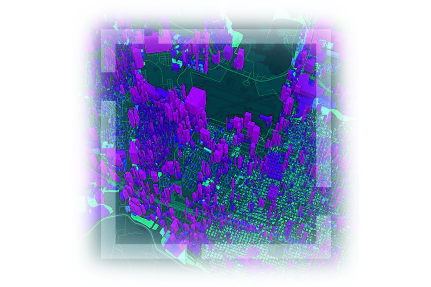
Realistic simulation and planning

Simulate real-world scenarios, optimize resource allocation, and minimize risks. Use 3D models and terrain data to assess project impact.

Enhanced communication and collaboration

Facilitate effective communication and collaboration by presenting data in a visually compelling and interactive manner to support shared goals.

Map of cityscape that includes orange roadways and gray 3D buildings

Unlock unparalleled insights with ArcGIS

Explore spatial data from new perspectives and gain deeper understanding for more impactful decision-making.

Enhance data comprehension with 3D visualization

Explore spatial data from multiple perspectives, revealing new patterns and insights with ArcGIS 3D visualization capabilities. Seamlessly integrate data sources and gain a comprehensive understanding of your data like never before.

Realistic visualization

Create realistic and immersive representations of geographic features, landscapes, and urban environments. Enable users to visualize data in a way that closely resembles the real world to enhance comprehension and decision-making.

Dynamic perspective

Dynamically change perspectives and views of the data from different angles, heights, and distances. This interactive capability provides a deeper understanding of spatial relationships and allows for better exploration and analysis of your data. 

Dynamic perspective

Dynamically change perspectives and views of the data from different angles, heights, and distances. This interactive capability provides a deeper understanding of spatial relationships and allows for better exploration and analysis of your data. 

A 3D representation that shows the replacement of a short building with a tall, narrow building on a land plot near a river,A 3D representation that shows the replacement of a short building with a tall, narrow building on a land plot near a river

Spatial analysis

Visualize spatial analysis in three dimensions with ArcGIS so users can more accurately assess and analyze spatial relationships and patterns. Utilize line-of-sight analysis, viewshed analysis, volumetric analysis, terrain analysis, and more to assess the visual impact of proposed scenarios on the environment.  

Dynamic data integration

Integrate and visualize real-time data from Internet of things (IoT) and sensors in ArcGIS. Combine different data types and sources to gain a comprehensive understanding of the dynamics of a spatial environment.

Time-based visualization

Incorporate temporal data to visualize and analyze changes over time in spatial data. ArcGIS enables monitoring and analysis of dynamic phenomena such as urban growth, environmental changes, or transportation patterns.  

Communicate and collaborate

ArcGIS provides powerful 3D visualization tools for communication and collaboration. Share interactive 3D visualizations with stakeholders, allowing for better communication of spatial information and facilitating collaborative decision-making processes.

Empowering industries with 3D visualization capabilities

ArcGIS provides powerful visualization tools for an array of industries to improve communication and collaboration for more effective decision-making. Gain enhanced comprehension, analyze spatial relationships accurately, and monitor changes over time to make informed decisions.

Previous
Next

Need more information?

Email us

Questions about buying ArcGIS, pricing or need support? Email us at solutions@esribelux.com

solutions@esribelux.com

Contact customer support

Visit our support page

Visit

Call us

Speak with a representative

32 (0)2 460 74 80